The fault line for many of my 19th-century ancestors, as well as for my own early years, runs north-south along the mountains that form the border of southeastern Idaho and Wyoming from Montana to Utah, bookended by thermal geysers.
The fault line begins just north of the cattle and horse ranch my parents worked when I was born on the banks of the Henry’s Fork of the Snake River in the very Yellowstone-Teton nook of Idaho which had been homesteaded by my great-grandparents and grandparents.
The fault line ends just south of Soda Springs along the old Oregon Trail, where the verdant oasis of upper Cache Valley is formed between the Bear River and Wellsvile ranges of the Wasatch mountains.
I didn’t need the television westerns of the late 1940s and 1950s to get a glimpse of the real Old West. We traveled its roots several times each year along this fault line between visits to the homes of my paternal and maternal grandparents located at each end.

The route was first blazed by bands of Northern Shoshoni and Bannock (a northern Paiute-speaking minority population among the Shoshone) Native Americans especially after the mid-1700s when they became the first of the northern tribes to adopt horses, a technology that enabled them to successfully pursue and harvest herds of Buffalo.
Following the expedition of Lewis and Clark, the first European American explorations of the north end of this fault line were conducted in the first decade of the 1800s by John Colter and then Andrew Henry for whom the North Fork of the Snake River of my origins is named.
By the 1820s when fur trappers such as the legendary Jim Bridger began to use full length of this route, the thinning herds of Buffalo were requiring members of these tribes to travel further and further north, always making sure to avoid the territory of the Blackfeet and Crow.
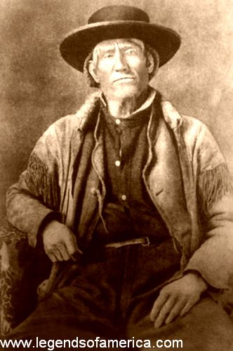
The Buffalo had all but been extinguished by the time three of my ancestors, two paternal (Shumways) and one maternal (Harper,) spent a day with Bridger (101 years to the day from the time of my birth) at the fort he had established (actually a small trading post with some out-building lodges) four years earlier on the Black Fork of the Green River in southwest Wyoming.
If my pioneer ancestors had headed northwest into Idaho, as Bridger first recommended, through the South Pass dividing the northern and central Rockies to settle in upper Cache Valley just below Soda Springs along the Oregon Trail, they would have passed by the future site of a small dam on the river feeding Bear Lake, later maintained by my maternal grandparents while I was growing up.
Instead, they initially headed southwest and deeper into what was then Mexican territory and through the Wasatch mountains into the 17-mile- wide, 25-mile-long Great Salt Lake Valley. It may not have been as lush and fertile as Cache Valley but contrary to myth, Bridger knew the valley of the Great Salt Lake was anything but barren.
As two of my ancestors, who were among the first three to enter the valley, began to immediately plant crops, they would have looked out on high Rocky Mountain plateau, covered by not only sagebrush, a sign the soil was good, but tall grasses and trees and bushes lining the numerous streams that flowed from pine-forested mountains across the valley floor to the Jordan River.
But in 1860, just more than a dozen years after spending the day with Bridger and four years after settlers first entered the lower extreme of this 50-mile-long, 20-mile-wide valley, two other great-great-grandparents, Bowmans and Neeleys, pioneered the firsts settlements in upper Cache Valley after all, including Franklin, the first town in Idaho.
Centuries before, the fault line route of my youth had been blazed north from Cache Valley by Native Americans to the nook along the Henry’s Fork where another pass through the Tetons carried them into Jackson Hole and up into Yellowstone.
For the nearly 40 years before my ancestors settled upper Cache Valley, Mountain Men such as Bridger had further deepened this route of my youth, holding the very first Rendezvous’ during the mid-1820s at each end of this fault line.
Within a few short years of my ancestors pioneering the south end of the fault line, gold discoveries first in Idaho and then south-central Montana, meant the route north along the southeastern edge of Idaho was quickly converted into a stage line carrying carried passengers, supplies and gold to and from the east to fund the war intended to preserve the union.
However, at the time, this stretch of Idaho between the Montana gold fields and Utah border remained largely uninhabited. Skirting, in part, what was known as Jim Bridger’s Bad Lands, the route was marauded by gangs euphemistically known as “road agents.”
These masked robbers on horseback often carried sawed-off shotguns and over just a two or three month period in the fall of 1863 they killed 102 people leading to a rise in vigilantes along the route and by the end of the decade regiments of U.S. Cavalry.
At the dawn of the 1860s, Native Americans along the route were becoming shell-shocked by the stream of migrant wagon trains crisscrossing their ancestral lands but more than that, they were starving as game was made more scarce and driven further and further away while grasslands used to raise horses was converted for cattle.
Any flare-ups were quickly contained as especially Mormon settlers attempted to peacefully co-exist, believing it was always easier to “feed than fight.” One of my paternal great-great grandparents often served as an interpreter between settlers and Shoshoni bands as they resolved conflicts in upper Cache Valley.
However, as gold was discovered, interactions were convoluted by the bigoted treatment of Native Americans by those just passing through in search of riches including droves of pro-slavery secessionists as they confronted those seeking to create a homeland.
The Civil War back east had already recalled the “best and the brightest” talent from federal agencies in the west where events involving Native Americans were exaggerated by the desperate need for gold to finance the war effort.
As war broke out, another of my maternal great-great grandparents named Messersmith, left the Nevada goldfields where he had partnered with a Missouri boyhood friend, who would later become famous as the author Mark Twain, so he could enlist in a volunteer Union Army Cavalry Regiment formed in California and tasked with protecting the routes where gold was carried from that state through Nevada, Utah and Idaho to the east.
In the summer of 1863, as President Abraham Lincoln was delivering his unifying address following the turning-point Battle of Gettysburg, the United States was at war on two fronts, one against the slave-states of the south and another against Native Americans in the west.
The name of my Cavalry-trooper ancestor does not appear among those in a detachment that was surely witnessed by another ancestor as it rode past his Nashville farmstead north of Franklin, Idaho just five months before the Battle of Gettysburg.
A handful of miles further up the Bear River, these troopers conducted the first and largest of the massacres of Native Americans that would occur in the three decades before the declaration in 1890 indicating that the west was won after the Massacre at Wounded Knee.
A few decades later, when my maternal grandfather and his brothers and sisters formed a small horse-drawn wagon train behind my great-grandparents and headed north along this route to new homesteads near the Tetons, they passed that Nashville crossroads where my soon-to-be-grandmother lived. They also solemnly rode past the site of the Massacre at Bear River.
During their 15 day-journey along that 200 mile fault line of my youth to their new home along the Tetons, they camped one night at Fort Hall, the reservation where Bannock and Shoshone tribe members retreated following a post-massacre agreement with the federal government brokered at Fort Bridger.
My then-19-year-old grandfather’s memoir notes that he felt uneasy that night as “Indians” gathered around their campfire, but with me as I was growing up, he was always in awe of Shoshone-Bannock prowess as fellow horsemen.
With my daughter this summer, I traveled along portions of this ancestral fault line as we were returning from an annual lake-side family rendezvous along the northern Idaho border with Washington state.
We traveled Interstate 15 rather than the blue highways such as US 20 and US 30 that I traveled with my parents as we used to shuttle along the fault line between grandparents during holidays. But the portion we did travel that afternoon took us through the Fort Hall Reservation, ironically now estimated to add more than a third of billion dollars each year to the economies along the route.
Two treaties in the aftermath of the Massacre at Bear River first created the Fort Hall Reservation but were never ratified, nor was peace along the route to the Montana gold fields guaranteed by President U.S. Grant’s 1868 and 1869 ratifications of treaties with some Bannock and Shoshone bands following a series of guerilla skirmishes known as the Snake War.
Native Americans who had once ranged over the part of Idaho roughly below where the Salmon River dissects the center of the state as well as eastern Oregon and northern Nevada and Utah and up into northwest Wyoming with occasional forays as far away as Mexico and Canada were now forced onto just 1.8 million acres at Fort Hall.
Encroachment meant the reservation was further distilled down to just 544,000 acres triangulated today by the towns of American Falls, Pocatello and Blackfoot.
A few months after Grant’s treaties and the completion of the transcontinental railroad, army surveyors passed through the Fort Hall Reservation along the fault-line route of my youth, accompanied by an official documentary photographer and joined later by a guest painter courtesy of the soon-to-be Northern Pacific Railroad.
At the northern end of the route, where I would be born nearly eight decades later, the team surveyed first the Idaho approaches to Yellowstone and then entering the northern gateway from Montana, what would result less than a year later in an act signed by Grant to create the world’s first national park accompanied by euphoria and hyperbole around its potential for tourism.
However, less than a decade after Bannocks and Shoshone were cornered onto the Fort Hall Reservation and a handful of years following the creation of Yellowstone National Park, news announcing the 1876 defeat and massacre of General Custer and his 7th Cavalry at the Battle of Little Big Horn was delayed by a telegraph malfunction in Bozeman, Montana so the dispatcher cut south down the fault-line route along the southeastern edge of Idaho.
At Eagle Rock (now called Idaho Falls) his purpose was thwarted again by an equipment malfunction so the rider continued south past Fort Hall and past the farmsteads of my ancestors to Franklin in the upper Cache Valley where he was finally able to announce the tragic battle’s outcome to the world.
Custer had been tasked with protecting survey and construction crews building the Northern Pacific, in part to open Yellowstone Park to tourism. Ironically, less than a year after Custer’s last stand, during a 115-day inspection of the Pacific Northwest, Union Civil War hero and then-US General of the Army, William Tecumseh Sherman took a few days with his son to be tourists in Yellowstone Park, noting how vulnerable it was to desecration.
At the same time, inflamed when the government reneged on agreements and attempted to force them onto a still smaller reservation, a very peaceful, eloquent and reluctant Chief Joseph along with nearly 800 Nez Perce rebelled along the border of Oregon with Idaho.
Joined by a few bands of Palouse and Northern Shoshone allies, over a five month period, these descendants of tribesmen who 70 years earlier had guided Lewis and Clark through north-central Idaho, repeatedly clashed along the same route with US Cavalry as they fought their way 1400 miles across central Idaho and then crisscrossing down the Bitterroots where Idaho and Montana divide.
The warriors and their families passed just a few miles north of what would later be the ranch of my boyhood and into Yellowstone Park where some renegade members encountered 22 tourists, killing two, before turning north into Montana and finally surrendering just short of the Canadian border.
Halfway through the dramatic 1877 flight of the Nez Perce, fearful of starvation during a famine, Bannock and Shoshone bands at the Fort Hall Reservation on the southern end of my fault line route along the southeastern Idaho border, grew impatient with the failure of agents to deliver food and other treaty promises.
The warriors broke out of the reservation and waged a series of conflicts across southern Idaho along the Snake River plain and into eastern Oregon known as the Bannock War before surrendering again to Fort Hall.
The Snake River is named for Shoshoni not because that is the meaning of their tribal name but because of the undulating sign they would make whenever identifying themselves.
I was born a little more than 50 years after the so-called end of the American frontier which was declared 122 years ago in 1890. Memories were still very fresh along that 200 mile north-south fault line of my youth as I came of age.
During my grandparents lifetime, tourists in Yellowstone were entertained with staged-attacks by “Indians” during during horse-drawn “observation” wagon tours of the Park’s wonders.
I felt a sense of reflection and remorse as my daughter and I traveled once again this past August along that fault line and past the Fort Hall Reservation. If only we had fully incorporated Civil War general-then-President Grant’s policy for not only the reconstruction of the southern states but also the peaceful integration of Native Americans.
Based on the findings of the then-relatively-new science of social anthropology espoused to Grant by Lewis Henry Morgan, a Republican state senator and the Quaker, Sir Edward Burnett Tylor, the enlightened policy was all too soon undermined by those seeking only revenge.
All of this is to say, that as a nation, not only are we still trying to resolve the issues at the heart of the Civil War, but we’ve never fully come to grips with what was done to Native Americans as the west was settled.
(As sources to help piece together this family history backgrounder, I have used background and memoirs related to personal ancestors such as Harper, Shumway, Neeley, Messersmith, Bowman and White as well as personal memories.
I’ve also studied and gleaned perspective from The Shoshoni Frontier and the Bear River Massacre by Brigham D. Madsen and fascinating and highly-recommended new texts such as Empire of Shadows: The Epic Story of Yellowstone by George Black and Atlas of Yellowstone by Marcus, Meacham, Rodman and Steingisser.)
No comments:
Post a Comment