Showing posts with label Protected Federal Lands. Show all posts

Wednesday, January 21, 2015

Prosperity Linked to Proximity to Protected Lands

News headlines about my native Intermountain West always seem limited to a few angry white extremists with guns or elected officials pandering to campaign contributors eager to exploit its natural resources.

Rarely, by the time news gets back to Durham, North Carolina where I live, does it provide more nuanced coverage of this complicated region including news of studies that run counter to those narratives.

Studies I’ve been reading, including one that analyzes the 284 non-metro counties in the west as a whole where there are substantial amounts of protected federal lands, are fascinating.

One study zeroed in on those with lands protected for conservation and analyzes non-metro, county-level economic performance in these places from the present to, in some cases, back as far as the 1970s.  Others analyze the performance of a all 413 counties in the 11 contiguous western states.

The current wave of anti-regulation rhetoric dates not to the 1960s regulations to protect water, air and the food supply or when the EPA was created as many assume or the anti-government rhetoric used by the Reagan administration but not shared by the American public in the 1980s.

The anti-regulation chant of today has its roots in 1947, when partisan post-WWII Republicans resumed the drumbeat of how regulations are a burden regulations are on business, while dismissing that without them an even greater burden is shouldered by individual Americans.

I was born and spent my early years during this period in a million acre- Idaho county wedged into that nook between Montana and Wyoming.  Only 31% of the land area was in private hands such as our ancestral ranch just west of the Henry’s Fork.

More than 58% of Fremont County is under federal protection on behalf of all Americans including a portion of Yellowstone National Park and the Targhee National Forest.

To put this in perspective, the amount of federal lands in my native Fremont County, Idaho is 3.6 times the land area of Durham County, North Carolina where I live but with only 3% of the population.

Only 67,642 acres of the more than of Fremont County is protected for conservation purposes and relevant to the study of all 284 non-metro counties in the west with such lands.

The studies were done by the independent, non-profit, non-partisan Headwaters Economics based in Bozeman, Montana, up and over the Continental Divide and 150 miles north of our ranch where my parents eloped as my dad headed off to WWII.

The study was conducted to determine if these projected lands were associated with decreased or increased economic performance.  The numbers show that performance is higher for every 10,000 acres of protected federal land a county has.

It turns out that the economic performance in non-metro western counties with protected federal lands is as much as 345% on average compared in some areas compared to 83% for non-metro lands in the west with no protected federal land.

Between my junior and senior years of high school, I read A Wilderness Bill of Rights by Supreme Court Justice William O. Douglas, who grew up along the eastern slopes of the Cascade Mountains in Washington State.

Appointed when he was just 40 years of age, his time on the highest court spanned from when my dad was in high school until my law school days.

His words transformed my spiritual and restorative feelings about nature into an entitlement for all Americans, as important as freedoms of speech and religion.

It had a profound impact.

Five years after Douglas retired from the high court, as President Ronald Reagan was elected, the news media, made the mistaken assumption that his popularity meant that his anti-government rhetoric must be widely shared, amplifying partisan news releases.

But both the news media and publicists were mistaken.  Polls following the election showed that only 21% of Americans shared that notion, about the same percentage as in 1976, possibly contributing to approval ratings for Reagan that several years later dipped into the 30% range.

It is the same today.  Americans don’t share anti-regulation rhetoric when the consequences become clear even though the term regulation has been sequestered and demonized my entire lifetime .

Campaign strategists then and now were brilliant, seeking not to sway public opinion but to make certain words radioactive such as environmentalist, federal government and taxes, creating a political correctness that distorted the self-perception of Americans.

It still gridlocks us today.

I much prefer to look at analysis of the actual numbers, not because they will change anyone’s mind but because they provide relief.

Oh, and by the way, studies show that non-rural counties in the west that are exploited for natural resources, actually in the long term suffer economically.

Just sayin’.  Too bad facts don’t have lobbyists.

Friday, January 16, 2015

A Spiritual and Economic Dividend

I was too distracted by the magnificence of the peaks towering ahead to pay much attention a few years ago when with Mugs, my English Bulldog and travel companion, we twice crossed the Two Medicine River.

So too, has most of the mainstream media, failed to notice two remarkable developments there recently.

That afternoon, Mugs and I were on one of our annual cross-country road trips to rendezvous with family lakeside in the Northern Rockies.  The 60-mile Two Medicine River spills out of mountain lakes on the east side of the Continental Divide in Glacier National Park.

But it quickly cuts a deep valley, creating cliffs as it goes through the southwest part of the Blackfeet Reservation, a tiny fragment of the ancestral lands for that people in Canada and the U.S.

Where the Two Medicine drops out of the mountains to create its valley is known as the Rocky Mountain Front, which marks the meeting of the Rockies and the Plains.

As an aside, had it not been for the influence of gold interests in Congress, the front was meant to be the border between northern Idaho and Montana, denying the latter its distinctive western Indian Chieftain-like face and making it more Dakota in shape.

I was born and spent my early years on an ancestral ranch about three hundred miles south just on the western side of the Divide in that Yellowstone nook where Idaho, Montana and Wyoming meet.

This nook is also where several Indian cultures met long before Mountain Men would rendezvous there including the Blackfeet, Shoshone and Crow peoples.

These three groups from my youth really did fit the stereotypes applied to Native Americans in the late 1800s by Dime Westerns and Wild West shows including being great horsemen, living in teepees, and wearing deerskin, war bonnets and beads.

I was most familiar with Northern Shoshone, for whom one of my great-great grandfathers had been an interpreter in the early 1860s during a time of intense misunderstanding.  Tragically, he was unable to prevent a massacre by U.S. Cavalry a few miles from my grandparents place.

These ancestors lived in territorial days along the Cub River and an old Shoshone trail between winter and summer grounds, later also used by the Pony Express.  It was about 175 miles south of the ancestral ranch of my youth.

It has long been thought that around the mid-to-late 1700s while in meeting places such as where I grew up along the Tetons, that Shoshone introduced horses to bands of Blackfoot.

The Shoshone had been introduced to these transformative animals by Cheyenne coming up from what is now Kansas after having first adopted them in 1745.

Of course these are Anglicized names for these peoples.

Blackfoot is the name for the tribe in Canada, Blackfeet is the name given in the United States, which bothers many members.  I grew up taught to use “feet” for the group and “foot” for an individual member or band.

But the name comes from a loose translation in English describing the dark moccasins worn by this nation, a confederation of several groups connected by language.

The group along the Two Medicine would have called themselves Piikáni or Piegan, as they do today.

Until a few months before Mugs and I crossed the Two Medicine, prevailing theory was that individual families and bands organized into larger groups when they came into possession of the horse.

But when oil and gas leasing created an urgency about cultural sites long revered by the Blackfeet, archeologists from the University of Arizona were led to dig into a site along the cliffs above the Two Medicine.

They learned that organizational social changes began not with the horse, but as early as A.D. 900, when a dramatic increase in precipitation along the plains resulted in high grass and led to a dramatic increase in Buffalo populations.

Something remarkable occurred along the Two Medicine by around A.D 1500, still two hundred years before they had the horse, just after Europeans established permanent settlements along America’s eastern shores, and 300 years before the Blackfeet would encounter members of the Lewis & Clark expedition.

Ancestors of the Piegan Blackfoot developed a sophisticated system of coordination and planning needed to develop a series of cairns, which are stacks of stones creating chutes through which they would drive Buffalo over the cliffs as a means to harvest food and hides.

They devised not just one but nearly a dozen of these along a 20-mile stretch of the Two Medicine, roughly bookended by the two westerly routes we traversed across the Rocky Mountain front that day.

Except for those in my native Yellowstone nook, Buffalo were extinguished from Idaho by the 1840s when my ancestors began to settle in the Rockies.  They were gone from Blackfeet country by 1881.

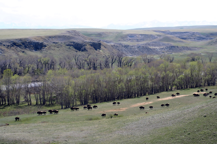
But their preservation on tribal lands is as much spiritual as economic.  Along one of our crossings of the Two Medicine that summer was a tribal herd of 250 Buffalo, part of 20,000 on tribal lands in the U.S. today.

A few months ago, near that crossing, the Blackfeet were among many to sign the Northern Tribes Buffalo Treaty, committing to the preservation and conservation of Buffalo.

A few miles south of my crossings of the Two Medicine, another significant development has escaped the mainstream media.  In December, Congress passed and President Obama signed into law, the Rocky Mountain Front Heritage Act.

It was the result of 37 years of passion and advocacy including a law that was passed in the early 1980s, after the Forest Service began leasing every acre of the Front for oil and gas development, only to be vetoed by President Reagan.

Along a hundred miles of Front I drove that day, the new bipartisan legislation designates 67,000 acres of National Forest as part of the Bob Marshall Wilderness and the Scapegoat Wilderness.   It protects another 208,000 acres in a conservation management area.

The conservation area prevents the expansion of motorized use, prohibits new roads and protects horse, foot and cycling trails as well as what biologists consider among the top 1% of wildlife habitat in America.

An average of nearly 70% of the private land use in the three counties most involved is still used for pasture, rangeland and cropland.  The legislation had the support of many ranchers including Dusty Crary near Choteau.

Tourism and recreation, along this stretch of Rocky Mountain Front, now generates 19% of employment and growing.

In the West overall, areas such as this along federally protected lands are associated with higher rates of job growth, 345% between 1970 and 2010, compared to 83% in non-metro counties with no protected federal lands.

There is definitely a dividend from conservation.