Showing posts with label unique sense of place. Show all posts

Thursday, March 06, 2014

Seems Like Yesterday

My first visit to Durham, North Carolina was twenty-five years ago this month for my final interview before being selected to head the formation of the community’s first community destination marketing agency as a means of fueling visitor-centric economic and cultural development.

I retired going on five years ago, but Durham is still my home.

This month is also the 25th anniversary of the launch of the Internet for general use, something that a new Pew study, released a week ago, shows is considered a good thing personally by 90% of Americans and by 76%, a good thing for society.

Eighty-seven percent of American adults now use the Internet.  Sixty-eight percent connect to it with mobile devices such as smartphones and tablets.  But a stubborn 17% of Americans still insist that old fashioned, tethered land lines will be very hard or impossible to give up.

More telling is that only a third of Americans now say the same thing about television.

The timing of my arrival in Durham and the availability of the Internet for commercial use was fortuitous.  As a co-worker once said, “we hit fast-forward without saying goodbye to yesterday.”

I took that to refer to the fact that we adopted the latest office productivity technology including a local area network of desktops and inter-office emails.  Yes, that was in 1989 when less than 4-in-10 Americans used computers.

Within a few years, we began using the Internet for marketing Durham, when more than two-thirds of the population had still never heard of the Internet or were only vaguely aware (21%.)

Back then, with only 14% of Americans using the Internet, it was considered a strategic risk, as any good strategy-making is.

At the same time, we made Durham’s unique sense of place and what we would later call place-based assets, including Durham’s inherent nature of “genuine, authentic and diverse,” our keystone strategy.

By the time our more established competitors caught on to the former we had leapfrogged nearly all of them but what really made that edge sustainable for Durham was that only one other would ever seize on the latter.

Of course, there were other decisions that proved fortuitous as well, such as spearheading a grass-roots effort to reclaim Durham’s story and reverse a negative image stubbornly embedded among residents of nearby communities.

Marketing a community is 1/3rd hurdling barriers and 2/3rds lowering barriers, reversing image was part of the latter.  No amount of investment in the promotional third (hurdling barriers,) can overcome the other two-thirds (lowering barriers) alone.

I often get asked how we made those decisions.  The easy answer is that I had already cut my teeth on various aspects in a previous communities including one that was data driven.

There are several other more complicated variables, but one important one is that I answered to an unusually diverse governing board made up of movers and shakers not only in business but in community and neighborhood-making.

They enabled and entrusted us to take those approaches that then seemed novel and now seem so safe.

Of course, I continued to evolve and even with nearly two decades of management experience by then, including a decade and a half as CEO, I still had a lot of evolving to do.

A lot of it was timing, much of it was luck and a good deal of it was a forgiving community that allowed me to make and recover from mistakes.  A place that believed in me, stood up for me and taught me the importance of place.

Anything we accomplished has been greatly transcended by those still spearheading the marketing of Durham because they grasp Durham’s story and because they benefit from that uniquely balanced governing board.

Twenty-five years ago seems like yesterday, hell, 60 years ago seems like yesterday.

Wednesday, December 18, 2013

Envy And Facility Addiction

It is in common use there now, but the first time I heard the phrase that “Raleigh has Charlotte-envy” it was used in an op-ed by a Raleigh publishing entrepreneur.

And he wasn’t referring to the popular massage franchise.  It was obviously a pejorative relating to North Carolina's two largest cities.

Similarly, Charlotte is said to have Atlanta-envy and Atlanta, well, let’s just say the reference is used to describe communities with a penchant for building facilities that make them resemble other communities at the expense of being less distinctive.

Overall, Durham, NC where I live has resisted that route but over the last two decades that resolve has been gradually undermined by forces  who are facility-driven, some external, some internal.

At stake is a distinct cultural identity and unique sense of place.  Being facility-driven is a slippery slope and Durham is well advised to learn from communities that are.

Many people trace Charlotte’s infatuation with facilities to 1959 and construction of the Charlotte Motor Speedway, which is actually in Concord, North Carolina.  Being overreaching seems be a side effect of having facility addiction.

But the earliest seeds of this addiction there may have been planted when that community’s first convention center, a 1911 private venture, failed and the city agreed to bail it out the owners.

Ironically, this first taste of Charlotte facility addition occurred just as the Olmstead Brothers (NYC Central Park) were laying out part of the Dilworth neighborhood, one of my favorites to visit and a remnant of which stands as a monument to when Charlotte valued more sense of place.

Contrary to a popular perception, I don’t think Charlotte was responsible for the misleading nomenclature for the speedway nor was it due to any infatuation by the founders.

Dating back to 1924, Charlotte had been the geographic home to a number of speedways including one that was called the Charlotte Speedway and another named the Charlotte Motor Speedway.  Ironically, the earliest races had been Indy cars.

When today’s Charlotte Motor Speedway was erected in 1959 in Concord, one of the partners was a racer and the other a car salesman who promoted races back then at two short-tracks including the old Southern States Fairgrounds Speedway at the Charlotte Fairgrounds.

Another was the Concord Speedway in South Concord which still exists approximately midway between the cotton farm where he had been raised and his new speedway.

Therefore, the name Concord Speedway wasn’t available.  But a few years earlier, the name Charlotte Motor Speedway had become available when the old track in Charlotte had been converted to a junk yard.

Simply put, the name was available and no truth in addressing was required, a registration loophole that still fosters ambiguity in far too many locations even today.

This period of name/location convolution and being viewed as a bedroom community for a namesake track may also be the genius of Charlotte identity issues that persist today.

But that city’s fascination with “coliseums” had begun with the opening of the “original” Charlotte Coliseum in 1955, now known as Bojangles Coliseum.

The “original” was supplanted by the “old” version in 1988, a facility that would be replaced and demolished before it was paid for by yet a newer facility which opened in 2005.  Each has been inhabited by a revolving door of pro basketball teams.

The “original” venue was populated by the Carolina Cougars of the American Basketball Association which was purchased in 1969 and moved to Greensboro, NC from New Orleans by a former North Carolina Congressman and unsuccessful Gubernatorial candidate.

Interestingly enough, according to the founder, he had won the then-fledgling Greenville, NC-born Hardees, now the nation’s fifth largest fast food chain, in a poker game less than a decade earlier.

The ABA experimented with “regional” venues that rotated home games to several cities.  In addition to Greensboro, the team played in Charlotte and Raleigh with even a few games in Winston-Salem.  Charlotte pressed for more games but Greensboro had the more active fan base.

The Cougars and the rotation idea weren’t that successful and new owners moved the team to St. Louis in 1974 where the team was not included in a merger with the NBA in 1976.

But Charlotte had caught facility fever and opened a new convention center just as the Cougars departed.  Maybe it isn’t coincidence that this was also when the Dilworth neighborhood began to fight for its life, just as the now highly coveted neighborhood does today as a five-story hotel is planned in its midst.

Within a decade of losing the Cougars and opening the convention center, Charlotte had built a new coliseum and community leaders secured an NBA franchise.  They also compulsively began agitating for a new convention center to keep pace with other cities.

Within another decade, their basketball team relocated to New Orleans (just desserts I suppose,) over a dispute for newer yet arena.  Soon after in through the revolving door came a new convention center and an NFL expansion team, the Carolina Panthers.

The Panthers privately financed their new stadium but leveraging $55 million in public sector contributions to secure the land and provide infrastructure improvements.  Otherwise it may have been built out across the county line from the Concord-base Charlotte Motor Speedway.

The team had been awarded to Charlotte but the owners pitched the team as a “Carolinas” team.  Regional names or slogans are now used as a means to try and fend off future teams in nearby cities or states or shun them as the Durham Bulls have by claiming to be “The Triangle’s Team.”

Charotteans were incensed the first year of play in Charlotte when the coach of the Dallas Cowboys couldn’t say for sure where the Panthers played (was it North or South Carolina where the team played its first season?) but there was nothing in the name of the stadium or the team to give him a hint.

It is unfortunate for host cities when denied the ability to fully leverage the advantages of identity with sports teams and facilities.  But it is a much larger price when communities become facility-driven.

The condition is irreversible as is the toll it takes when public resources are shackled away from being able to truly foster a community’s distinctiveness and sense of place which in the long run reaps far greater returns.

Facilities and sense of place work best when the former is kept in check and carefully calibrated to enhance the distinctiveness of a community.  Reverse the priority and communities lose their soul as well as any sense of perspective and proportion.

In the decade after Charlotte opened its mega-convention center, attendance at meetings nationwide dropped by another third, a long term trend.  Yet a decade after it opened, a newspaper headline there quipped, “convention center half empty, officials propose expansion.”

Charlotte’s other cultural facilities have also not been immune to the churn of facility addiction, often becoming pawns between development schemes.  Like any addiction, one for facilities becomes a furious, insatiable spiral with each fix demanding another and another.

Communities addicted to facilities also become event driven, using public dollars to “buy” events to create the illusion of activity masked by the use of metrics that gross up but fail to net out impact making it nearly impossible for the general public or news media to see that these subsides rarely return enough to cover the subsidy.

This is not due to a cover up.  Models don’t factor in the dislocation of existing activity or even many leakages.  Even when carefully calibrated to day-trip vs. overnight activity they don’t dig deep enough to account for in-kind public sector expenses such as security and sold waste.

Officials would rather explain an event subsidy that an operational deficit and local government accounting by its nature is not full-cost accounting, making it impossible to connect the dots.

The importance of distinctiveness and unique sense of place have only become more fully understand in the last decade.  For communities where it isn’t too late, they should be given full consideration in lieu of becoming facility addicted.

Often it comes down to whether a community is comfortable in its own skin.  Durham, which is, cannot afford to be too smug.

Wednesday, October 09, 2013

Planting Place-Based Assets

I’m blessed to be surrounded by more than 110 trees on my tiny lot near downtown Durham, North Carolina but as of last Thursday there are two less.  That’s right, I “clear cut” two trees.

It is called “thinning,” and  I do this once a year to keep my private forest healthy.  At the same time, four or five new tree naturally regenerate and on average, I plant one or two new trees each year.

The ones that were thinned last week were trash trees crowding out a healthier specimen while making the shade too dense for understory shrubs and trees.  Thinning is as important to an urban forest such as Durham’s as tree planting is and even more essential in an urbanized environment.

With a friend, I try to walk an extra 10 miles each week.  I also motorcycle on various routes through both the city and county.   This gives me a leisurely opportunity to observe Durham’s urban forest and how it works.

The terrain in my neighborhood is particularly hilly and forested.  In fact, the tree canopy in Durham, which is 40% citywide and 51% countywide, is a pivotal part of the community’s unique sense of place and appeal.

By  comparison, only 62.6% of the entire State of North Carolina remains forested.

A community’s unique sense of place is comprised of a distinct blend of three categories of place-based assets.  One category of assets are nature-related including a community’s rocks and geology, wildlife and parks, trees and vegetation, rivers and lakes and overall terrain.

Another category of place-based assets is cultural including the heritage, history and socio-economic make-up of a place.  The third category is “built” including architectural character, use of building materials such as brickwork, neighborhood personalities and public spaces.

Every community or state has these general categories, so sense of place isn’t about being unique as much as it is about weaving, preserving and blending these three categories of place-based assets into a distinctive whole.

This isn’t about replicating other places or emulation or erecting palaces.  It is all about working within the inherent place-based assets of a community to reveal and amplify its almost temporal personality as it has evolved over time.

The objective isn’t to achieve universal appeal but to seek to be genuine, indigenous and authentic.  Durham has had numerous caretakers who understood this over the over nearly 200 years.

Communities that make the effort have a shot of having a “there, there.”  Those that dismiss the importance of place or fail to guard it end up in the words of Dr. Scott Russell Sanders, “feeling more like jumbles than communities.”

The former have more appeal and potential for visitors, newcomers and economic vitality.  For the latter, “tourism devolves into only a form of shopping.”

I spent two decades of my now-concluded career in visitor-centric cultural and economic development, protecting, preserving and promoting Durham’s sense of place.  So I step softly while noting that overall, it seems some here are much too complacent - if not inconsistent - about protecting and fostering its sense of place.

And in no area does this show more than in upkeep and preservation of its urban forest, although through no fault of those directly involved day-to-day.

I don’t just mean street trees that line the roadways that make up 80% of its public space or its 2,700 acres of forested parkland or the tree “deserts” revealed on images via Google Earth.  I am also  referring to much-needed thinning of understory growth on public and private property forestland, where it remains.

Within the city limits, Durham has less than 1.4 acres of trees remaining for every acre of impervious surface.  County-wide, Durham desperately needs to get serious about a program to compensate for the covering over in development of an average of 2.5 acres a day since 1976. (source: RENCI Growth Mapping)

That average is forecast to be increasing to 3.91 acres a day between now and 2040, and a far greater proportion than that is cleared of trees for each development.

The fact that Durham’s ratio of acreage of tree canopy to acreage of impervious surface will soon be barely 1 to 1 must become of great concern to more than just those charged slowing storm run-off.

Durham was recently selected to host one of seven Google for Entrepreneurs Tech Hub Networks, and I’m sure officials are pouring over the TED report released last week entitled 7 Ways Our Cities Will Change.

Meanwhile, a crucial element of our sense of place is quietly disappearing.

I was born in 1948, during a 10-year lull between two incredible national tree-planting initiatives.  From the mid-1930s until the mid-1940s, Americans planted 2.3 million trees a year.  Then from 1956 to 1961, they planted another 2.2 million trees a year.

According to Dr. Neil Maher’s book entitled Nature’s New Deal, many on the ideological right were opposed to such programs because they feared the places the workers stayed while planting the trees would be a haven for Communists to infiltrate the working class.

Privately, the fear on the right, as it is today over the Affordable Care Act may have been more that the success of these problems would foster dependencies and fatten constituencies for Democrats.  Reasonable but as it is today, a bit paranoid.

Instead, these encampments turned out to not only provide a strategic solution to some big over-arching problems at the time by providing a “hand up” instead of a “hand out,” but as Maher documents, they simultaneously aided the Americanization of millions of immigrants.

Many of Durham’s street trees were planted in the 1930s as part of those programs.

Another national tree planting program was initiated under President Reagan in 1985 to return highly erodible land back into forestland, stream buffers, wildlife habitat, wetland preservation and ground cover after farmers had begun harmful “fence to fence” cultivation of marginal lands.

In 1988, the year before I was recruited to Durham, it resulted in the planting of 3.4 million acres of trees, the highest ever recorded.  In 1990, President H.W. Bush proposed planting a billion trees over a ten year period.

A few years ago, it was estimated that tripling this number annually would be a way to sequester a billion tons of carbon gasses but it would require reforestation or afforestation of a quarter of all undeveloped land in the US.

More than 4-in-10 of the trees planted today are by private property owners but they are often incentivized to do so by state and local officials who plant 7% and National Forests, which are responsible for planting another 6%.

New York City, which is roughly the same land area as Durham County but with thirty times the population, plants 8,000 trees a year, 2,000 street trees alone, and is on its way to planting 1 million new trees.  To date, private partners have planted 250,000 of those trees.

For some, it may seem Durham is doing pretty good to plant 1,000 trees a year but keep in mind how hard it is for New York, compared to Durham, to find places to plant 8,000 new trees each year.  The goal shouldn’t be calibrated to keep up but for Durham to plant enough trees here to replace several acres being lost each day.

But part of any goal should be thinning and improving the tree canopy we have.  Trees offer an incredible array of benefits to public health, property values, economic development, crime reduction, air and water quality, soil conservation and many others, but they also must be put in balance.

It isn’t just a question of more trees but needing tall trees with a wide canopy, placed strategically to minimize fragmentation and promote biodiversity with properly spaced clearings to maximize health and regeneration, as well as efforts to efficiently reforest.

A good goal for Durham, broken down into planting on public property, incentivizing and zoning planting of trees on private property along with facilitating natural regeneration would be 100,000 trees a year for a minimum of 10 years but better still, as an ongoing practice.

Sounds like a lot until you realize it will just barely hold the community harmless for tree loss due to development.

Monday, January 28, 2013

The Serendipity of Acquaintance in our Lives

A week ago last Friday, I had an interesting conversation on the last leg of a cross-country flight to visit my daughter and grandsons. My seatmate for that stretch had worked on the documentary Blackfish with director Gabriela Cowperwaite.

The film was being shown the next day at the Sundance Film Festival in Park City, Utah.  When he learned that I live in Durham, North Carolina, he asked if I had ever been to the Full Frame Documentary Film Festival held there each April, which of course, I had.

As the flight crew interrupted to announce preparations for landing, my attention turned to the snow-covered peaks of the Wasatch Mountains that frame Salt Lake City from the east and I began thinking about how serendipity such meetings and conversations can be.

It brought to mind a time nearly 40 years ago when I headed up the newly-created community-destination marketing organization for Spokane, Washington, and became acquainted with two very accomplished inventors, Ray Hanson and Luke Williams.

Hanson, who passed away a few years ago, was another Idaho native who, while studying engineering at the University of Idaho, had invented an automated self-leveling attachment to enable efficient harvesting of wheat on the steep hillsides of the Palouse region.

This was just one of over a hundred patents for products he manufactured in Spokane and sold in 50 countries around the world.  At the time we met, Hanson was even more famous for having invented equipment that laid down entire highways and dig huge canals with the motto of “a mile a day.”

Little did either of us realize that the next move in my career would be Anchorage as we discussed the invention he used to help construct the just-completed Trans-Alaskan Pipeline.

Ray also planted the bug that led me later in life to learn to ride heavy motorcycles and take flying lessons.  He had owned a WWII era P-51 Mustang fighter and introduced me to a friend and former airline pilot in Spokane who at the time rehabilitated WWI era Boeing-Stearman biplanes, which became a part of Spokane’s eclectic appeal.

I first met Ray while snow-skiing a new area, one of several in a 50 mile radius of Spokane, that with his support had been re-built in the 1970s and rechristened 49 Degrees North.  In part, he may have even been an inspiration for a Ski The 51st State promotion the organization I led produced.

Luke Williams, after graduating from the same high school where I would later spend my sophomore and junior years, had returned from World War II to found a neon sign business with his brother.

In 1951, the Williams brothers invented the electronic time and temperature signs which rapidly became ubiquitous outside bank branches.  Luke believed signs such as that needed to serve a public purpose as much as capitalism.

The invention helped evolve their company into the huge American Sign and Indicator Corporation in Spokane but by the time I met Luke in the mid-1970s the company had moved on to developing stadium scoreboards, again marrying public service to signage.

He took an interest in my career in community-destination marketing because the organization was intended to leverage the success of Expo ‘74 into long-term visitor-centric economic and cultural development.

As part of the World’s Fair, Luke had been instrumental in persuading the state to construct an opera house and adjacent convention center and then then after the Fair to give it to the community for a dollar.

Luke definitely planted a vision for me that while tourism development has commercial aims, it should significantly also leverage historic preservation, the arts and unique sense of place.

Shortly after I left Spokane for Anchorage, Williams’s sold American Sign which was was relocated to another state and later dissembled. In 2004 Luke passed away.

As the wheels touched down on my flight, it occurred to me as it often does now in retirement, just how we gain from even brief encounters with the people we meet during our lives.

And by the way, the day before my return, I read that CNN Films and Magnolia Pictures had partnered to secure distribution of Blackfish.  The documentary will be in theaters by summer and air on CNN sometime during the year.

The film covers the same 40-year span, one in which Orcas have been captured and trained for commercial tourism purposes.  As the CNN release notes, “ultimately, it is a story about the life and death consequences of a spectacle that has thrilled millions.”

It also illustrates a type of tourism that is very different than the place-based tourism endorsed by the two inventors I came to know at the beginning of my career.

Friday, October 05, 2012

Calculating A Goal For Reforestation of Durham NC

The amount of money allocated for urban forestry by elected officials in Durham NC, where I live, is sufficient to plant, nurture and maintain 350-400 trees per year, only if residents and volunteers contribute additional treasure and sweat.

That’s only a little more than the number of trees needed each and every day just to replace the number of trees our community loses to development in order to sustain the economic, public health and environmental benefits a tree canopy yields to a community.

To put this into further perspective, New York City, which has roughly the same land area as Durham County (304.8 vs. 290 square miles not including water surface,) including the Borough of Queens which covers approximately the same land area as the City of Durham (109.2 vs 94.6 sm,) plants 8,000 trees a year, 2,000 street trees alone.HorseBarns-5

Durham makes the mistake many communities do when it limits urban forestry to just those on City-owned or maintained property such as parks and right-of-ways.  Places such as New York understand that urban forest management includes a community’s entire tree canopy.

Waiting for the next public budget hearings to get Durham on track will be much too late.  Priorities are being established with the City management right now and they have customarily resulted in targets for each department and division that focus on being the same or lower than the previous year.

If you are like me, you hope that elected officials and administrators are looking strategically at the needs of the community, using “best practices” and scientific studies as aids to help develop a budget to meet those needs and communicate it to the general public.

But in reality, their limited resources are fully absorbed by the task of figuring out how to divide up the pie and juggle priorities.

This is how our street maintenance got so far behind that we had to pass bonds to catch up.  Streets aren’t the only type of infrastructure – gray, brown and green – that was allowed to degrade and it would have been far less expensive to incrementally maintain each and every year.

So many services in Durham have fallen so far below “best practice” that people have forgotten what those benchmarks are or have settled into the routine of just cutting or adding a certain percentage.  So something such as urban forest management doesn’t even come up for review as a resource or infrastructure to maintain, only a cost.

Following an in-depth urban forest resource analysis in 2007, New York City set a goal of planting a million trees during the current decade or in other words to increase its tree canopy of 5.2 million trees by 20%.  They have already reached 612,000 trees and counting.

Per year that breaks down into planting approximately 20,000 additional or replacement street trees, 30,000 trees planted by residents or private partners, 48,000 trees planted by Parks, Storm Water and other agencies as well as reforestation required by zoning regulations.

The NYC goals also focus on biodiversity and native species, not just the number of trees planted.  I am sure it includes a heart to heart with big box nurseries and residents about what constitutes native and the size trees must be able to reach to truly generate economic, health and environmental return.

Durham’s vaunted street tree canopies that contribute so much to the sense-of-place and property values in its historic neighborhoods are aging out.  People who take these lush canopies for granted need only peruse photos taken before 1930 to see how Spartan the community once looked.

Here is my first pass at some of the facts Durham needs to consider in setting its own goals for urban forestation:

  • County-wide, Durham has 11.2 million trees in its urban forest.  Net those that may have naturally regenerated, we’ve surrendered 1 million trees to impervious surface in the last 30 years or so.


  • Part of any urban forestry goal for Durham should be to gradually replace the million trees lost during those years – replanting, nurturing and maintaining, for example, 91 trees a day over the next 30 years.


  • Based on forecasts, net those trees that will naturally regenerate, Durham also needs to plant or incentivize the replanting of 152 trees per day to replace those that are forecast to be surrendered to additional development or impervious surface over the next 30 years.


  • A zero-loss strategy then would be to reforest 243 trees a day (88,695 per year) through a variety of means including ordinance requirements, incentives to residents and other private property owners and by public agencies such as storm water, parks, public works, public health, urban forestry etc.


  • Remember, I am suggesting that this be phased over 30 years, not trying to duplicate the ambitious goal of a million trees in a decade that was set in NYC, and it nets out those trees that may naturally regenerate and even the nurturing of those could be incentivized.


I am sure there are other ways to calibrate a goal for reforestation of Durham.  I’ll happily share the metrics behind the goals shown in this blog, but another approach could be to index the amount reinvested in reforestation or afforestation to the proven dollar benefits of overall urban tree canopy, such as those so thoroughly documented for NYC.

One thing is for certain, yielding annual benefits worth $2.3 billion,  Durham’s tree canopy is a resource well worth managing to its fullest potential.

Thursday, September 13, 2012

New Study Benchmarks Tree Cover and Impervious Surface

The more than 50 large trees along the banks of sensitive Erwin Creek which were clear-cut this summer by an out-of-state billboard company included large cherry, elm, maple, cedar, pear and myrtle varieties.

They had been capturing, slowing and cleaning not only storm water from the impervious surface of I-77 but along the opposite bank from over and under a site long-identified as toxic.

Caring nothing about the costs they were passing along to the citizens of Charlotte, the billboard company was only interested in becoming even more visible the now-just 1 in 12 people who in the course of a year might buy something due to the messages on the huge board while avoiding the costs it was passing along to the citizens of Charlotte.

Should the outrage of Charlotteans demanding replantingErwin Creek Cuts along the banks of the creek ever be given consideration, hopefully it will be more than just plopping down some twigs or saplings from a home improvement store.

Ecolotree, based in North Liberty, Iowa is doing some amazing things with phytoremediation using hybrid poplars and willows such as that being done along hog lagoons and elsewhere.

Ecolotree’s CEO notes in a recently published book by Jim Robbins that “one willow can process fifteen gallons of waste a day, and a field of a thousand trees on an acre can treat ten gallons of toxic water per minute.”

The impervious surfaces of the highway and the parking lot which covers the toxic spill which embrace each side of Erwin Creek have long been proven to create run-off that is hazardous to human health and that is why the trees were preserved when the highway was built.

A newly released study by scientists David Nowak and Eric Greenfield, based in Syracuse, NY for the National Forest Service, has quantified both the amount of tree cover and the amount of impervious surface in each state of the United States as well as in urban and community areas.

Tree cover over the conterminous US, or what we called the “lower 48” when I was in Alaska, is now estimated at 659 million acres or 34.2% of the total acreage.  When Alaska and Hawaii are included, tree cover nationwide in urban/community areas is estimated at 35.8% or 43.7 million acres.

Tree cover in North Carolina is now estimated at only 62.6%, less than New York, South Carolina and Virginia but more than Tennessee and we’re needlessly surrendering our signature asset at no cost to things such as billboards.  North Carolina’s urban and community areas are covered with urban forest canopy by 48.2% and 50.3% respectively, about 8% of the overall statewide tree cover.

By comparison, in Durham, where I live, the county as a whole has just 51% of its tree canopy remaining and only 40% remaining in the city where urban foresters are funded to plant a net increase of only 150 trees annually, after removals for disease etc., and this amount is futile in the face of the uncounted thousands clear-cut for any single development.

Impervious surface, including roads, parking lots, buildings etc., in the lower 48 is now estimated at 45.5 million acres or 2.4%.  In urban/community areas alone it is estimated at 18 million acres or nearly 15%.

While only 4.9% of North Carolina is covered with impervious surface, more than 32% of that is in urban/community areas such as that embracing Erwin Creek along I-77 in Charlotte.  Urban and community areas in North Carolina average 18.5% and 17.3% respectively.

That average is on the low side compared to many other states but for comparison, within the city limits of Durham, the fourth most populous in the state, there are 19,176 acres of impervious surface which is 27.6% of the overall land area, a proportion more typical of the average for urban areas in about half of the other states, according to the study.

Durham is the only city in a very compact county which doesn’t track impervious surface so the comparison may not be “apples to apples.” But it is clear that in a city where only 27,780 of tree cover remain to help scrub the runoff from 19,176 acres of impervious surface, a ratio of 1.4 to 1, we must do much more to fuel urban forestry than a net 150 trees a year.

Taken statewide, the ratio of trees to impervious surface is 3.3 to 1, making it even more tragic that the new legislation that legalized the atrocity along Erwin Creek does not protect trees in communities such as Charlotte or Durham contrary to what its chief sponsor verbally assured the General Assembly from the floor.

In North Carolina the percentage of tree cover is 12.7 points less in urban/community areas while and impervious surface 12 points more in urban/community areas than in rural areas.  This tells me that compared to other states in the report, we may also be deforesting and paving over rural areas.

Interestingly, in many states such as Iowa, through which I traveled on a cross country road trip last month, the urban and community areas are forested by 24% and 18.8% respectively while the state as a whole is only 10.4%.

But even in small towns, Iowans are careful to make sure they have tree canopy, as are many farmers and ranchers around their homes and barns and equipment sheds.  One huge spread I spotted along I-80 as I returned from my trip had very deliberately planted a tree every few feet around the entire border as well as mini forests along ravines.

That is why I blogged a few months ago that maybe some in our state, which has been blessed with naturally occurring hardwood and evergreen forests, have become a bit too smug.  We take our trees and the fact that we’re aided by regeneration far too much for granted.

To sustain our state’s urban growth and still retain the scenic character and quality of life (and health) so central to our state’s economic vitality, including tourism, we need to look more seriously at a more intense and holistic approach to forest management including:

  • Reforestation and afforestation of not only urban areas but also rural areas.
  • Higher state and community standards for tree cover in and around parking lots and along roadways.
  • Manifestation by the NC Department of Transportation that it is as much in the business of managing forests for ecosystem services on behalf of the public as it is focusing attention on highways.

Monday, September 10, 2012

The 1980s - Durham’s Pivotal Sense-of-Place Decade

In 1984 then-Durham Chamber of Commerce exec Bob Booth was inspired to hire Jeff Downin, who had just earned a Master’s degree from Duke Divinity School, to head up a new Chamber division, then called government affairs.

The roster of those who went on to head public policy for this business-advocacy organization in Durham, NC, where I live, is stellar and none more so than John White, who currently holds that post.

Maybe it was divine influence or maybe it was the timely board leadership of the legendary Travis Porter, a friend whose image is shown in this blog and who passed away a few years before I retired after having served as an ex-officio on the Chamber’s board for nearly two decades.

Together in 1984, Porter, Booth and Downin, who would move on a couple of years later, can be credited with the Chamber’s wise assent to Durham’s decision nearly thirty years ago to ban and remove billboards along its roadsides in defense of the community’s scenic character and I believe, in an effort to preserve the sanctity of its signature trees.

W. Travis PorterPorter was a gravel-voiced lawyer, a tough former Marine and a practical, old-school North Carolina progressive who blended business community concerns with larger-community concerns.  He understood that a chamber’s role is as much to advocate on behalf of the community to businesses, many owned or managed by non-residents, as it is to advocate on behalf of those businesses to the community.

Forward-thinking chambers back then were already eschewing the antiquated notion that nothing noteworthy happened in their communities unless the chamber was a convener.  Instead they had begun to grasp that is far better to focus on being included at the table as equals with other strategic partners in the community.

These were also the days before so many chambers began to be neutralized by billboard representatives (or their surrogates) who began, as well documented by internal correspondence, to strategically infiltrate committees and even boards of directors banking on the hope that cronyism could protect them from revealing conflict of interest and serve to divide chambers from the best interests of their communities.

Also in 1984, the Durham Chamber nodded approval as community leaders germinated two other actions that have proven equally pivotal to fostering and promoting Durham’s sense-of-place.  One of these was the formation of a committee charged with shaping community consensus for a zoning overlay to protect I-40 along its path through this community which including prohibition of billboards as well as a wide range of actions to preserve and plant trees along that roadway.

Durham also laid the groundwork back then for the 1986 passage of state legislation including a provision for formation of the Durham Convention & Visitors Bureau (DCVB) as the community’s official destination marketing organization, envisioned, in part, as the “defender of Durham’s image and brand and guardian of its unique sense of place” and the start-up of which brought me to Durham in 1989.

Coupled with the 1981 and 1985 emergence of Durham’s first adaptive reuse of historic, brick factory buildings, this troika of 1980s initiatives signal the genesis of the bedrock of sense-of-place into the reinvention of a community which has evolved to its resurgence today as one of the most highly ranked communities in the nation across a wide and diverse number of benchmarks, earning the signature “where great things happen.”

Booth continued to make inspired choices to guide the Chamber’s public policy and government affairs efforts.  When Downin moved on he was replaced by Frank Smiley, a native returning to North Carolina after serving a career as a city manager in the Great Lakes region.

Smiley, who past away down east the year I retired, made certain with the leadership of Wayne Hays, then head of the Chamber board, that DCVB, the organization I was recruited to jump-start in 1989, would be formed as an independent organization and that its mission and resources would be safeguarded and not siphoned off as they often had been in prior decades by some chambers or local governments in other parts of the country.

As the 1990s emerged, Booth also tapped another inspired choice when Smiley moved on.  Nick Tennyson, another Duke grad and a former developer headed that Chamber division for a several years before moving on to head of the homebuilders association that represents three of the four counties that make up the Durham metro area and serving two terms to end the decade as the Mayor of Durham.

No one deserves more credit than Tennyson for paving the way for the massive American Tobacco Campus, one of many successful projects which ride on the shoulders of those 1980s adaptive use pioneers including West Village, Peabody Place, the campus of Measurement Inc., Golden Belt and now several adaptive reuse projects in the City Center such as 21C and a few more in the organic but unofficial NoCo district, each fostering the “built aspect of Durham’s sense of place.

But It is important to never forget that the path for these successes along with the preservation and promotion of far more temporal aspects of Durham’s sense of place was laid in that pivotal decade of the 1980s.

Wednesday, July 11, 2012

A Time When Infrastructure Was Bipartisan

During my first five years of grade school in the 1950s, even out west, construction of the Saint Lawrence Seaway seemed to dominate each issue of the Weekly Reader with news about how it would enable huge cargo ships to transit to and from the Atlantic Ocean as far as 2,500 miles inland via the Great Lakes during nine months of the year.

During my recent visit along the eastern shoreline of 7,300-square-mile Lake Ontario and up through the 1000 Island Region where the Saint Lawrence River spills out of that lake as it straddles the US border with Canada, I spent plenty of time on the water with friends but we were still an hour or so below the six huge locks on the up-river end of the Seaway.

Unlike today, Republicans during the 1950s seemed to be inspired by President Eisenhower to make huge infrastructure projects such as the Seaway and the Interstate Highway System, bi-partisan in nature.

Actually there are actually nearly 1900 islands in the lake-like-archipelago that dots the fifty mile stretch as the Saint Lawrence River emerges from Lake Ontario, under the Great Depression-era-150’-high bridge from the US to Canada and heads northeast toward the Seaway locks.

Officially, “the number of islands was determined using the criteria that any island must be above water level all year round, have an area greater than 1 square foot, and support at least one living tree,” and several are populated with late 19th century mansions such as Boldt Castle, operated as public attractions by the bridge authority.

On the trip back home, we couldn’t resist cutting east first through the “green” infrastructure of Adirondack State Park, which encompasses nearly 20.2% of the land area of the State of New York, nearly the size of Connecticut and larger than several national parks combined.

The purpose of our drive a few days ago was recreation but that is only a by-product of the primary purpose of the park.  In fact, the Adirondack was created and then preserved forever by a popular vote of the people of that state as infrastructure to prevent soil erosion, control flooding and preserve watershed and water quality.

My great-great grandfathers x 7 understood the importance of this infrastructure when they settled in the early 1600s just 30 to 40 miles downstream from the southern edge of what is today Adirondack Park.  Skilled at lowland farming, one family settled an island in the middle of the Hudson that was sensitive to flooding.

Shortly after their takeover two decades later, the English began to aggressively deforest the Adirondacks and this accelerated after the American Revolution when New York sold off lands owned by the Crown for pennies an acre to pay off war debt.

By 1850, New Yorkers became alarmed at the huge price of deforestation in terms of soil erosion, flooding and water pollution.  It took another 35 years for the state to begin protecting the sustainability of what became more than 6 million acres including 57% that are privately owned and 1% owned by towns and hamlets.

The Adirondack is truly spectacular, with 3,000 lakes, 30,000 miles of streams and rivers, 2,000 miles of hiking trails and 46 mountain peaks that are more than 4,000 feet above sea level.

But parkland infrastructure such as this is ultimately far more crucial to commerce and water quality as well as prevention of soil erosion and flooding.  Frankly, it is nearly impossible to imagine elected bodies today being that strategic.

Those we elect to safeguard and maintain infrastructure of all types are negligent, if not criminal, when they dismiss infrastructure as mere recreation and then starve it instead of providing much-needed maintenance and upgrades.

Monday, June 18, 2012

An Inspiration For Scenic Preservation

In May 1997, less than three months before he would pass away, journalist and North Carolina favored son, Charles Kuralt delivered a moving speech to the nation’s scenic character preservationists.

In a way Kuralt led me to North Carolina in 1989 just as he was receiving the Bill Sharpe Award for public service to the industries involved with tourism here, coincidentally the same award given to my successor, Shelly Green, a year ago.

By the time I relocated here 23 years ago, I had already been viewing and listening to his “On The Road” segments on CBS Sunday Morning for close to a quarter of a century.

His broadcasts spanned more than 30 of my now-concluded 40 years as a community destination marketing exec charged with leveraging sense of place into economic development.  He was an inspiration and continues to be in my retirement as an activist for preservation of scenic character.

In that speech to scenic preservationists, Kuralt referenced the dramatic line of demarcation between blight and scenic character on North Carolina’s Outer Banks:

“These two environments collide at the Mobil Station at Whalebone Junction. North of the gas station, nothing but scenic discord, which depresses people. South of it, all natural harmony, which elevates people.

I think of that Mobil Station as the fulcrum upon which is balanced the worst nightmare and the best hope of all of us in this room tonight.

Two Americas meet there: the ugly one and the beautiful one. And of course, Americans of their own free will created them both.”

The outdoor billboard industry, which deployed years of persistence and copious political campaign contributions to push a bill through the legislature, a year ago yesterday, authorizing the clear cutting of thousands of acres of public roadside trees, often characterizes people such as me to the news media as “anti-billboard.”

More accurately, we’re just “pro-scenic character” and “pro-sense of place.”  It is all a question of values. Those who value stewardship, including both aesthetic and economic values, readily embrace scenic character which is held as a value by nearly 8 out of 10 North Carolinians including a majority of Republicans, Independents and Democrats.

Re-reading Kuralt’s speech during the first anniversary of that tragic give-away in the legislature made me recall a detour I took in the fall of 2010 on the return leg of a cross-country trip that included stops to visit my daughter and grandsons and my mother and sisters.

My driving companion, an English Bulldog named Mugsy, and I had left Millcreek, Washington, north of Seattle late in the afternoon thinking we’d overnight in Spokane, but we just kept driving thinking we’d stop at the next town or the next town until we found ourselves nearing Livingston, Montana just an hour or two before sunrise.

While refueling, I decided to cut down US 89 into Wyoming and across on the 67-mile Beartooth Highway -- my first time on that road --before reconnecting with I 90 east of Billings and then continuing down past the site of the Battle of the Little Bighorn and through the gas and oil-filled plains of Wyoming to Gillette and then across the Black Hills to Sturgis, South Dakota.

General Custer rode to his last stand to protect the gold he had discovered in the Black Hills but beginning 61 years later, the year after the Beartooth Highway opened, a huge motorcycle rally held each year has helped Sturgis and this corner of South Dakota become better known for tourism.

Back to the west of its junction with US 89, the Beartooth ultimately connects via US 20 across Yellowstone Park and the Targhee National Forest to that nook on the Idaho side of the Tetons where I was born and spent my early years.

But this would be my first traverse to the east over the actual Beartooth Highway portion of the route zigzagging back and forth along the border of Wyoming and Montana through the western portion of the Custer National Forest to Red Lodge.

Kuralt mentions the Beartooth in his speech to those scenic preservationists gathered in 1997.  Years earlier, he had identified it as the “prettiest road in America” for an essay in Family Circle magazine only to see on a later visit that someone had erected a big billboard pointing this out without a hint of the absurd irony involved.

Kuralt didn’t live long enough to see the Beartooth named as one of the first ten roads officially designated an American Scenic Byway just five years after his death.

The Beartooth Highway was constructed during the initial years of the Great Depression, about the same time the Blue Ridge Parkway was being built along the western edge of North Carolina and under which I passed on a quick trip to Boone, NC last week.

As we drove the Beartooth into a spectacular sunrise, we crested a nearly 11,000 foot pass surrounded by 20 mountain peaks over 12,000 feet.  If our Jeep had been a plane, the cabin would have been required to be pressurized. We would descend 10,582 feet by the time we reached our home again in Durham, North Carolina a few days later.

Kuralt’s speech to scenic preservationists in 1997, which was made a few months prior to his unexpected death at far too young an age, is one of hope.  He chronicles how far we’ve come in choosing the “beautiful America” over the “ugly America” and closes with inspiration for those of us who continue that pursuit:

“I am persuaded of this with all my heart, ordinary Americans want a beautiful country. We are proud of the amber waves of grain and the purple mountains majesties. And we are not powerless. We can have, we really can, the land Amadas and Barlowe had seen – the Goodliest Land Under the Cope of Heaven.”

Friday, June 15, 2012

The Origin Of Our Sense Of Place

Studies show that city parks and natural areas give children a “sense of rootedness” and “aesthetic value” and “place making” and “supports the development of sense of place and attachment.”

This may not fully explain why a few ringleaders in the current legislature seem so driven to sacrifice North Carolina’s sense of place.

But it does further illuminate what gives some communities such as Durham, where I live, such a strong sense of place and attachment which is closely linked to economic and cultural vitality and the ability to attract and retain talent and pursue visitor-centric cultural and economic development.

Experts note that if a genetic switch is not flipped in a child they evolve into adults without compassion.  Apparently nature-based outdoor activity flips the genetic switch for stewardship of sense of place.

I’m not surprised that consideration is being given to converting a larger portion of some Durham city parks, such as Rockwood which is down the hill from where I live, back to a natural state although it might be more than a bit disingenuous to neglect the turf and then when it is overtaken by weeds to presume it is no longer useful because no one plays on it.

Historic parks such as Rockwood and Forest Hills are incredibly beautiful and useful but tend to be challenging to maintain because developers typically donated the land in flood-prone lowlands as a means to slow, capture and  cleanse storm run-off.

Still before they were neglected these parks had been beautifully manicured.

My 80+ year old and still very active neighbor remembers when she and her husband bulldozed the street where I live to build their home overlooking the park in the years after World War II, the City of Durham had to be reminded that Rockwood Park was public property.

Rockwood is widely used by both neighboring residents and commuters because it is cool and heavily forested, perfect for family and group get-togethers with a great playground for small children.  But it is also popular for walking pets, exercise and reflection.

Just as I was retiring a few years ago, the head of Duke School, a private Pre-K-8 institution in Durham, Dave Michelman, penned a great blog summarizing the value of unstructured, make-believe play and discovery as a means to increase children’s “self regulation, discovery, wonder and creativity.”National Kids Survey

Over parenting, including children sucked into the adult-driven ever hyper-active world of organized sports, is no substitute for what Michelman is wrote about.

Parents today are well-advised to adopt the Marine Corps “rule of threes” as a means to ensure sufficient unstructured time.

But studies about the importance of unstructured outdoor and especially nature-based activity have been lacking a “national baseline regarding children’s time outdoors and to determine what kids are doing or not doing outside, including factors that affect children’s activity choices.”

That was the purpose of incorporating a National Kids Survey into the rolling survey of Outdoor Recreation Trends And Futures (page 82.)  It turns out that 62.5% of children spend two hours or more outside on a weekday, 78.2% on a weekend which is more than many expected.

There are disturbing differences between girls and boys and ethnic and age groups, but overall 84% are just playing or hanging out while 49.8% are playing or practicing team sports.  This study notes that concerns about the shift away from nature-based activities is warranted.

Noted are studies supporting the fact that “direct play in nature is critical for youth cognitive and social development, especially during middle school years” as well as creativity, innovation and concrete skills such as way finding and an overarching sense of place.

More accessible and forested parks with a mix of nature area, well-maintained turf and playgrounds is part of the answer as are the quasi-unstructured exhibits such as those of the spectacular Museum of Life and Science in Durham.

The hugely popular museum is opening “Into The Mist” at the end of the month, its ninth outdoor exhibit which promises a “natural landscape where you can play, explore, and interact with the powerful forces and forms of the earth.”

But there is simply no substitute for time spent just exploring in the woods.

Among the most important factors, according to the study, is not only the emphasis on the unstructured and nature-based time children spend outdoors, but that parents are willing and able to spend time outdoors with their children!

Tuesday, June 12, 2012

A Crossbones Journey Through The Uwharrie

My best friend and I rode the Harley-Davidson Crossbones tandem (with a backrest and much better passenger seat than shown) this past weekend down and back from Durham, where we live, to Charlotte to visit mutual friends.

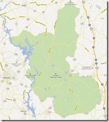
We carved a route down through the central Piedmont region of North Carolina, taking a southern route through Uwharrie National Forest on the way down and returning along the more northerly Uwharrie Scenic Byway, a little more than 300 miles round-trip.

Uwharrie is also the name of a mountain range and we were stunned at the highest crest on that route returning north and east to see a spectacular “Blue Ridge” type view of a mountain range in the direction of Durham. Uwharrie National Forest

I think it was probably the ridges of the small Cane Creek Mountain range that runs south and west from Burlington and Graham.  I kick myself for not pulling over to take a photograph but by the time it registered we were in descent.

A little known secret in state tourism promotions which are heavily weighted toward the mountains and beaches is that not only is the central Piedmont the most visited portion of North Carolina, thanks to the draw of cities such as Durham and Charlotte, but it is also incredibly scenic if you stick to state roads and especially scenic byways rather than Interstates. 

The Uwharrie is one of four national forests in North Carolina and at 51,000 acres it is the smallest.  It is an actively managed forest but it also features a primitive area in the northern portion and recreation areas.

It is also being used to reforest 100 acres of longleaf pines each year. According to the new book American Canopy, a huge arc of longleaf forests once covered 140,000 square miles stretching through nine states from southwestern Virginia to Texas, enough to cover every inch of North Carolina three times.

Beginning in the 1880s, this vast forest was “exhausted over the course of ten to twenty years” by northern capitalists.

The devastation of that period led to the establishment of forestry schools such as the first one here in North Carolina at Biltmore near Asheville.  Graduates were eventually hired by timber companies and helped usher in an era of sustainability.

The Uwharrie was purchased by the federal government during the Great Depression and made a national forest by President John F. Kennedy in 1961.  Today, longleaf reforestation already covers 800 acres in the Uwharrie.

But North Carolina’s 1.3 million acres of national forest are about much more than sustainable forestry.  Of the 7.5 million visitors to the forests each year, 48.5% go there to view scenery and 28% drive through them for pleasure, as we did last weekend, thereby adding to the renewable return on investment from these incredible  natural resources.

North Carolina’s current legislature seems bent on sacrificing the state’s natural resources, first turning the scenic roadsides over to outdoor billboard companies for clear cutting at no charge and soon for natural gas fracking.

Hopefully before it is too late North Carolina voters will intervene.

Wednesday, June 06, 2012

A Frackfull View And Sense of Place

I hear and read a lot about fracking, but the impact is hard to visualize.

Unfortunately, by the time I cut across southwestern Pennsylvania on my most recent cross-country drive it was nightfall.  I had been curious to see the effect of fracking on rolling countryside because Durham, North Carolina, where I live, is also underlain in part by a Triassic basin.

There are many aspects to sense of place here including geology and quality air and water.  But a sense-of-place asset that Durham also leverages to draw tourism and the talent necessary for other forms of economic development is the community’s incredible natural setting among the forests, lakes, rivers and hills and dales of North Carolina.

Fortunately, thanks to Marcellus Air, hundreds of aerial views document the impact of hydraulic fracturing on the visual aspects of sense-of-place including the thousands of mini-chemical plants required.

A scroll down through the photos on the links below is informative. 

First series of aerial images

Second series of aerial images

Third series of aerial images

(Look for others, as well as updates, in the legend to the left)

It isn’t hard to understand how excited the gas industry is to deploy this natural resource or the effectiveness of their campaign contributions on permissive legislative decisions.

I also believe the people behind the technology are sincere.  The problem isn’t the theory but, as with any technology, it is with the execution which often goes to the lowest bidder.

Is it worth the risk?  Is the development based on the long-discredited linear depletion model?

It doesn’t seem based on the much more sustainable closed loop (industrial ecology) model that fully accounts for all costs in the computation of cost-benefit including the incorporation of environmental externalities.

For me, the issue isn’t just whether we are going to be “fur or agin” fracking.  The question is one of values and whether the business model ensures values such as quality of water, air and sense of place.

If it doesn’t, then it much to expensive to risk at any level of benefit.

Tuesday, May 29, 2012

Is Desecration Marketing Ethical?

Community or state destination marketing organizations (DMOs) that still utilize huge, outdoor, static billboards need to consider whether it is ethical to use a medium that desecrates the places and homes and neighborhoods from which they hope to draw their visitors.

If not deemed unethical, at the very least the use of roadside billboards violates “sustainability” which is one of the three pillars of today’s values-based marketing, aka “marketing 3.0.”

If marketing intelligence suggests advertising as a part of the marketing mix for a DMO and outdoor advertising is somehow unavoidable, there are about 100 alternative formats to consider instead of using roadside billboards.

While the alternatives may still raise the issue of visual pollution in general, they do not require clear cutting 250,000 acres of roadside trees and vegetation nationwide, nor do these alternatives always violate the inherent right to a view by those using public roadways.

Using revenue as a guide, roadside billboards are now only 65% of outdoor advertising, which is now more accurately referred to as “out-of-home” advertising since much of it is not really outdoors.

Growth projections for out of home advertising often mask the fact that revenues for static roadside billboards have been down or barely flat over the last decade despite huge investments in and campaign contributions to secure the use of digital “enhancements” to these structures.

Beginning in the mid-1990s, the community-destination marketing organization for Durham, NC where I worked until retiring a few years ago, was the first to begin using eye-tracking by Perception Research Services (PRS) to ensure the effectiveness of its ad designs and layouts.  Today that service also includes measuring the emotive power of an ad by tracking facial expressions.

Although tempted from time to time and even pressured once by a devotee, the policy of that organization has always been to avoid using static, roadside billboards both because they destroy trees and blight quality of place bit also because Durham’s 1984 ban on billboards made it seem hypocritical to turn around and deploy them for advertising in other locations from which we pursued visitors. 

PRS has determined that some outdoor or out-of-home alternatives such as mobile advertising wraps on trucks, cars and other vehicles are 96% more effective than traditional static outdoor billboards and they generate 2.5 times more attention.  And they don’t require even one tree to be cut down.

In my opinion, two of the most basic rules of marketing today are 1) Don’t piss off more people than you inspire and 2) Do no harm.  Advertisers still using roadside billboard and the legislative enablers who permit the desecration they create are in violation of both principles.

In the words of marketer Scott Goodson, “instead of attempting to persuade people…marketers must try to tap into what it is that people already believe and care about.”  Overwhelmingly, research shows that people value roadside trees, vegetation and views more than advertising on billboards.

Marketing, according to Goodson, is now more about sharing what people care about than selling; and I believe community or state destination marketing is, at its essence, movement marketing.

Marketers who still use roadside billboards may find interesting the perspectives of Philip Kotler and Hermawan Kartajaya.  They define “marketing 1.0” as the way it was practiced during the industrial age when it was all about selling products without concern for what the customer needed or wanted.

Back then as it still is for many marketers now, the activity of marketing was “considered as mere selling, an art of persuasion, and even cheating.”

The information age ushered in “marketing 2.0” with its focus on helping customers find what they need and want even if it ends up not being what the marketer is offering.  This was what I practiced during the first part of my now-concluded 40-career as a community-destination marketing executive.

Kotler and Kartajaya define marketing today as the “human-centric era” or marketing 3.0, where customers are “treated as human beings who are active, anxious, and creative” and where sustainability is a core value and customers actively help shape the product or destination being marketed to them.

It could be that Jonah Sachs is defining “marketing 4.0” or at the very least 3.5 when he writes in his soon-to-be-released book Winning The Story Wars about “empowerment marketing.”  It isn’t a stretch to believe, as I do, that advertising should empower not desecrate the sense-of-place in communities and states where it is placed and viewed.

There is no place for the desecration marketing via roadside billboards in the age of human-centric empowerment marketing.

Two business school professors at Brooklyn College lamentably prophesied in a 2009 issue of the American Journal of Business that

“Corinthian-pillared buildings, gothic archways, monuments, and colossal skyscrapers once defined the architectural landscape of our cities.

Today outdoor advertising overpowers those landmark giants in cities in which we live and work, as advertisers find it progressively more difficult to reach people through other media.

Gargantuan billboards and other manifestations of this industry make this metamorphosis possible in urban and rural areas.”

When the authors of that article, professors Lopez-Pumarejo and Bassell, noted that outdoor or out-of-home advertising may be the “…only unavoidable realm from which to reach progressively elusive consumers…” they may have been referring to calculations which show that we are each bombarded now with and turned off by an average of 5,000 (soon to be 10,000) advertising images each day.

That clutter is up from just 500 a day in the 1970s when I first became a DMO exec, according to Dr. J. Walker Smith, now executive chairman of the global board for The Futures Company during a 2009 CBS Sunday Morning interview when he was president of Yankalovich Consumer Research during its merger.

Locked in an arms race according to Smith, it appears to me that even advertisers who know this clutter is driving the well-documented and dramatic decline in the effectiveness of advertising don’t seem to know how to stop the self-destructive implosion of this one element of marketing.

The responsibility should weigh even more heavily on those who market states and cities.  As Ed McMahon asked in an essay two months ago in Urbanland:  “Do you want the character of your city to shape the new development, or do you want the new development to shape the character of the city?”

Maybe a corollary for community and state marketers should be - do you want the character of your community or state and the places of origin of its visitors to be reflected in the sustainability of the marketing decisions you make? or do you want to enable visual pollution and let desecration such as billboards create define the character of your city or state?

If the answer is the former, start by making sure the marketing you practice lives up to the responsibility to curate and guard sense-of-place both in the places you represent as well as in the places from which you hope to draw travelers.

Friday, May 25, 2012

Riding A Harley In Stilettos

Two images struck me during a recent quick trip to Salt Lake City to visit my daughter and grandsons.

One image is that of a young woman in a tight black skirt, wearing stilettos and a coon skin cap astride a big black Harley-Davidson motorcycle riding alone down a busy boulevard past the 130-year-old Liberty Park as we headed up 700 E for a float at the now-50-year-old Hires Big H Drive Inn.

It enlisted a gleeful, “boy is she hardcore” from my single-mom healthcare-lawyer daughter.

The other image was of multiple streets lined with back to back billboards leading east and west to and from downtown Salt Lake City such as the one in the image from High Country News shown in this blog.

The huge boards mar an otherwise beautiful city and obscure the views of the Wasatch Range of Rocky Mountains that serve as its backdrop.  The desecration also irritates many times more people than the small percentage who may find it useful, a fact lost on the businesses that still keep this obsolete and increasingly desperate technology on life support.

This billboard blight is missing from the logo and images which are strategically used by Salt Lake’s community-destination marketing organization, but it nonetheless assaults visitors and newcomers and those residents who haven’t become callous to its existence.

There is a revolution in communities across the country, including Salt Lake City, against “visual pollution” as illustrated by a new seven and a half minute documentary by Ossian Or, who with his wife Sandra are among a growing number of marketing professionals joining this fight.

The 80-acre Liberty Park in Salt Lake was the first in that state, designed by its first formally trained architect, and it came only after the city’s extraordinarily wide streets had been established (purportedly so a wagon pulled by draught animals could pull u-turns.)

But in my experience, many architects seem ambivalent about community sense of place while others may have their information misattributed or overstated as in this flyer produced by an arm of the association representing the outdoor billboard industry.

The flyer lobbies for use of big billboards in mixed use developments and gives the impression that it is authored by a distinguished professor-emeritus of architecture.  A closer reading reveals that the flyer uses some of his case studies.  However, the photos showing dissonance between billboards and sense of place speak volumes.

Published five months ago, a far more enlightening analysis is Jonathan Snyder’s Beyond Aesthetics: How Billboards Affect Economic Prosperity.  As an urban planner, Snyder uses data to reveal the negative impact billboards have on property values.

Ironically, many downtown development organizations are “thick” when it comes to outdoor billboard blight including some cited in the billboard industry flyer above.

The downtown advocacy organization in Durham, NC, where I live, is lobbying for a tax so in part it can do marketing but expanding the agency’s web page to full screen shows a depiction of an outdoor billboard.

Whether due to oversight or a mistake or inadequate funding to make remedy, it stands as an obvious affront to Durham’s nearly 30-year-old ban on billboards.

The first lesson this downtown group can take in marketing is to be true to community-held values, the policy followed by Durham’s official marketing agency which is the guardian and curator for its unique sense of place.

Sense of place isn’t rocket science and it definitely isn’t as hard as steering a big Harley in a tight skirt and stilettos.

Thursday, May 10, 2012

Protecting Sense of Place from Mobs With Torches and Pitchforks

With a 1.5 to 1 favorability ratio nationwide and 39% unsure, Baltimore is evidence that it takes much more than a revitalized downtown and a trend-setting retro baseball park to fully rehabilitate a community’s reputation.

It is also one of the latest testaments to how tourism often kills the things it loves when a convention hotel, which a sports columnist in the region terms a "cruel cubist joke on a previously perfect ballpark," recently rose to block out the coveted view of the skyline there from Camden Yards.

That’s why, as a 40 year veteran of entities responsible for curating community sense of place to external audiences such as community-destination marketing organizations, I am relieved when I see thoughtful, data-driven and critical analysis being used to inform decisions and exhibit reservations such as those recently about the impact of cruise ships on Charleston, South Carolina or mega-casinos on South Florida.

I was just arriving in Durham in 1989 to spearhead an image turn-around here, where I still live, as construction was breaking ground for Camden Yards.  Little did I know as I marveled at the sense-of-place genius of building it in a warehouse district, that a move was afoot that in less than a year would try to relocate the Durham Bulls.

A proposal was on the table to relocate the team to an adjacent city and county willing to subsidize the building of what journalist Steve Rushin describes in a lyrcal  Sports Illustrated tribute to Boston’s Fenway Park as “state-of-the-art stadia …symmetrical quadruplets, multipurpose, multi-parking-spaced…” which displaced historic facilities around the country through the 1960s, 70s and 80s with concrete look-alikes.

“Stalked by baying mobs – of real estate developers, government officials and even proprietors - bearing metaphorical torches and pitchforks, wanting to do away with the beast…” as Rushin notes, historic and beloved facilities such as the historic Durham Athletic Park (DAP) were being displaced to a 65-acre geography of nowhere.

Durham was shell-shocked by the proposed loss of the Bulls, just months after the DAP, the team and the community had starred in the hit 1988 movie Bull Durham, still rated one of the top sports movies of all time and what historian John Thorn calls the “gold standard” of baseball movies.

Even the purported convenience of the proposed new location didn’t make sense. A student survey by North Carolina State University had confirmed that, without the warehouse ambiance of the old DAP and downtown Durham, the 60-70% of fans who commuted in from other cities were less likely to attend games.

Proving less and less differentiation, the era of customer satisfaction was already in its twilight and the era of customer experience was beginning to emerge.  People were drawn to be in environments that make them feel genuine and authentic.

Fortunately in Durham, the “baying mob” didn’t include one brave City Council member, Chuck Grubb who rallied community opposition, found funding and persuaded the teams new non-resident owner to support and, to his credit help shape a new-to-look-old “Camden Yards style” ballpark.

The city-owned Durham Bulls Athletic Park opened in the mid-1990s, still in downtown Durham, became the catalyst for the adaptive reuse of the historic Lucky Strike and Bull Durham tobacco factories into creative class offices.

The district now anchored by DBAP delivers on the overarching Durham brand including the slogan “Where Great Things Happen” and hopefully any new construction will never block out the skyline.

It is also unlikely that Camden Yards in Baltimore would have become what it is without the teamwork of long-time mayor and then governor, the late William Donald Schaefer and then-Baltimore Oriole president Larry Lucchino,who credits the look for the ballpark to “his best off-season acquisition”, Janet Marie Smith, an urban park planner.

At the turn of the century Lucchino became part owner and CEO of the Boston Red Sox and with principal owner John Henry and chairman Tom Werner rescued historic Fenway Park from the wrecking ball that had threatened it every decade or so beginning in 1958.

Fenway was last declared dead in 1995 just a year before as DBAP was set to open in Durham.  As Rushin notes in his Sports Illustrated tribute, Fenway dodged a bullet because the real estate magnate who proposed a new complex then turned out to be Frank McCourt who went on to bankrupt the Los Angeles Dodgers.

In fully renovating, restoring and updating Fenway to serve another century, Luchinno and his partners again brought in urban park planner Janet Marie Smith to work her magic on Fenway before she eventually returning to Baltimore and a role in renovating Camden Yard.

Sense of place is about much, much more than buildings but ballparks such as DPAB, DAP, Camden Yards and Fenway illustrate an important role and  Fenway illustrate something even more important.

Such a facility doesn’t have to be new to be “major league.”